
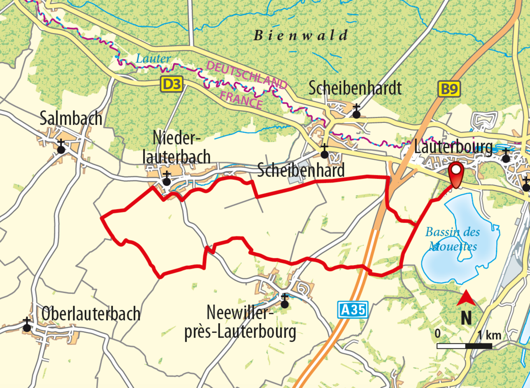
Climb to the Region’s Highest Point
20 KM I 0 HÖHENMETER I 5 STD. DAUER I MITTEL
SHORT DESCRIPTION
You won’t be disappointed with the stunning views on this walking route, which takes you through the wooded area along a branch of the Old Rhine and up into the hills to farming fields. Standing on the Néeweiler Peak, which is the highest point here at 183 m, you can see the Black Forest, across the Rhine Valley and Bienwald, and all the way to the Palatinate Forest and the Northern Vosges.
STARTING POINT AND HOW TO GET THERE
| THINGS TO SEE
|
PLACES TO STOP
- Lauterbourg: Restaurant Au vieux Moulin, S’Waldstuebel restaurant,
- Au Bord du Rhin, Au Cygne, La Fontana
- Salmbach: Au Tonneau Fleuri
[Translate to Englisch:]
CONTACT
OFFICE DE TOURISME DU PAYS DE SELTZ-LAUTERBOURG
2, avenue du Général Schneider • 67470 SELTZ
Tel. + 33 (0)3 88 05 59 79
info (at) tourisme-seltzlauterbourg.fr
www.tourisme-pays-seltz-lauterbourg.fr
Copyright photo on this page: © OT Seltz Lauterbourg
Copyright map: map.solutions GmbH


