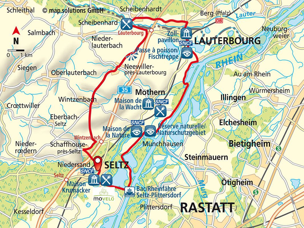
Cycle Route Between the Rhine, Sauer and Lauter

32 KM I 166 HÖHENMETER I 4:00 STD. DAUER I MITTEL
SHORT DESCRIPTION:
This cycle route is the perfect way to explore the Rhine, Sauer and Lauter Rivers. You can expect diverse landscapes, stunning views of the Northern Vosges and Black Forest and fascinating flora and fauna in the Naturschutzgebiet Sauerdelta (Sauer Delta Nature Reserve) in Munchhausen.
STARTING POINT AND HOW TO GET THERE
THINGS TO SEE
|
|
PLACES TO STOP
- SELTZ: auberge du Rhin – restaurant à l’Agneau; LAUTERBOURG: restaurant Au Bord du Rhin – restaurant Au Cygne – restaurant Au Vieux Moulin – Allo Pizza flam’s – La Fontana; SCHAFFHOUSE bei Seltz – restaurant à l’Arbre Vert
[Translate to Englisch:]
CONTACT
Office de tourisme du Pays de Seltz – Lauterbourg
2, avenue du Général Schneider; F-67470 Seltz,
Tel +33 (0)3 88 05 59 79, info (at) tourisme-seltzlauterbourg.fr
www.tourisme-pays-seltz-lauterbourg.fr
Copyright photo on this page: © OT Lauterbourg _passe à poissons - roue à aube à Lauterbourg
Copyright map: map.solutions GmbH